Map Of Judea And The Dead Sea
Discover the rich history, dramatic landscapes, and must-see tour sites of this historic region. From ancient fortresses like Masada to desert trails and archaeological wonders. This interactive map is your gateway to Judea and the Dead Sea, the lowest place on Earth.


Masada – A Symbol of Jewish Heroism
Site 1
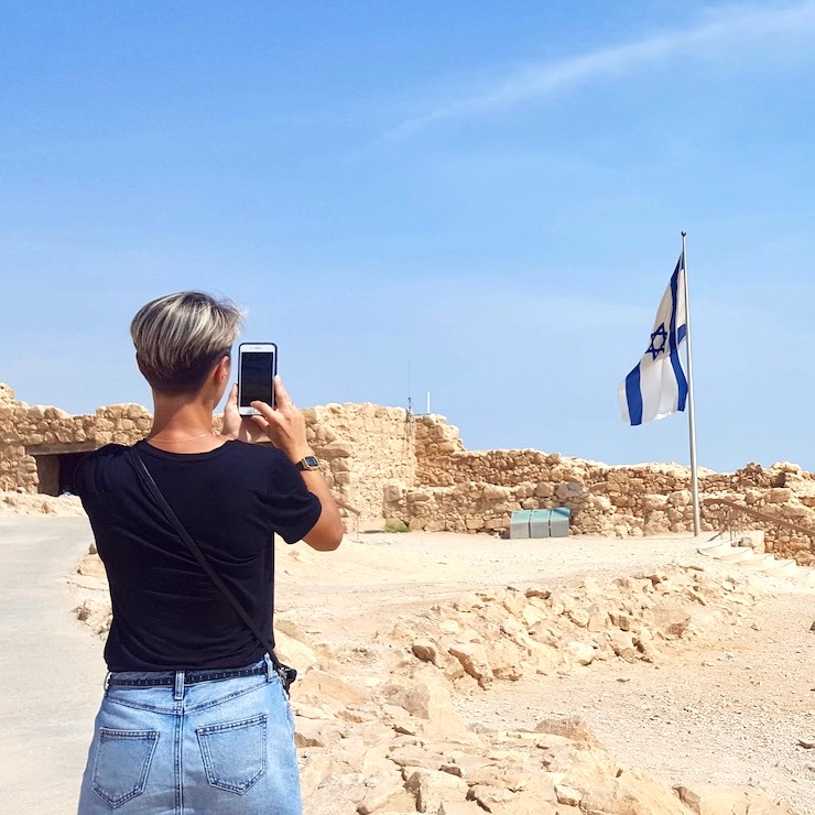
Masada is one of Israel’s most iconic and emotionally charged historic sites. Built by King Herod in the 1st century BCE atop a remote plateau overlooking the Dead Sea—rising about 450 meters (1,480 feet) above it—Masada was designed as a desert fortress and royal refuge in times of crisis. Known for his paranoia and many enemies, Herod constructed this stronghold far from political centers to secure his reign.
Decades later, during the Great Jewish Revolt against Rome, Masada became the last refuge of a radical Jewish group called the Sicarii. Often seen as a militant offshoot of the Zealots, the Sicarii were active throughout the revolt from 66 to 70 CE.
As Roman forces closed in, after the fall of Jewish resistance in Jerusalem, Masada remained the last stronghold where Jewish fighters still held out. Fewer than a thousand defenders chose a fateful path. Refusing capture, enslavement, or death at Roman hands, they committed mass suicide—a collective act of defiance and martyrdom. According to the historian Josephus, this was preceded by a stirring final speech from Eleazar Ben Yair, the group’s leader, urging them to choose death over slavery. This dramatic moment transformed Masada into a lasting symbol of courage, tragedy, and Jewish identity.
Masada uniquely combines historical text with archaeological evidence. Once known only from Josephus’s The Jewish War, the site was rediscovered in the 19th century and excavated extensively in the 1960s. The blend of literary record, architecture, and artifacts gives Masada a rare power in Jewish history and collective memory.
Today, visitors can explore Herod’s palaces, storerooms, and bathhouses, and walk along the Roman siege ramp that still scars the landscape. The summit views—especially at sunrise—are among Israel’s most breathtaking
What to See & Do:
How to Reach the Top of Masada:
By Cable Car
A fast and scenic ride from the eastern entrance (Masada National Park) takes you directly to the summit in just a few minutes. During weekends, holidays, and peak seasons, advance booking may be required. It’s strongly recommended to check availability and reserve your time slot in advance to avoid delays or disappointment.
The Snake Path (East Side)
A steep and challenging hike with sweeping views. It takes about 45–60 minutes to reach the top. Best done early in the morning, especially during warmer months.
The Roman Ramp (West Side)
A shorter and easier climb (about 20–30 minutes), following the path built by the Romans during the siege. However, reaching the western entrance requires a much longer drive around the mountain, making it less accessible for most visitors. Sometimes I am asked by adventurous groups—mostly young tourists—about taking this path early in the morning, before regular opening hours. Doing so can let them reach the top in time to watch the sunrise from the northern palace, though you should always check in advance if this option is permitted and open.
Short Film
If you start your tour from the Visitor Center, you can begin with the short film that introduces the story of Masada and sets the stage for your visit.
once you reach the top of Masada:
Fortification Walls
Walk along the impressive double walls that once protected the fortress. These thick stone defenses encircle the plateau and were reinforced with towers and guard posts.
Bathhouse
A classic Roman-style bathhouse built by Herod, featuring a changing room (apodyterium), cold room (frigidarium), and a hot room (caldarium) with a hypocaust heating system under the floor.
Officers’ Quarters
Living spaces used by commanders and possibly Zealot leaders. These modest rooms likely served as headquarters during the revolt.
Storehouses
Long rows of storage rooms used to keep food, oil, wine, and other supplies. Herod stocked them to survive long sieges—some were still in use during the Jewish Revolt.
Northern Palace
The most striking structure on Masada, Herod’s three-tiered cliff-hanging palace includes reception halls, living quarters, and panoramic views over the Dead Sea. Its design reflects Roman luxury.
Western Palace
A large and richly decorated administrative complex. It may have housed Herod himself or high-ranking officials.
Water System
An ingenious system of aqueducts and cisterns that collected flash flood water from nearby wadis and stored it in massive underground reservoirs—crucial for survival in the desert.
View of the Roman Ramp
On the western side, you can see the remains of the ramp built by the Romans during their siege of Masada. It enabled their troops to breach the walls with a battering ram.
Byzantine Church
Built in the 5th century CE, this small but well-preserved church with mosaic floors and a simple apse reflects Masada’s later use as a Christian monastic site.
The Museum
If you have time—before or after your visit to the top—stop by the museum (near the Visitor Center, at the base of the mountain).
It displays artifacts, weapons, and scrolls found at Masada, offering deeper insight into the site’s history.
Before You Go
To better understand the drama and history of Masada, it’s highly recommended to watch the Hollywood miniseries Masada (1981), starring Peter O’Toole and Peter Strauss. The film vividly portrays the Roman siege and the heroic last stand of the Jewish rebels. While not strictly historical in every detail, it brings the emotional weight of the story to life in a powerful and memorable way.
Qumran: Gateway to the Dead Sea Scrolls
Site 2
Qumran is a captivating archaeological site perched on the northwestern shore of the Dead Sea. It is best known for its association with the Dead Sea Scrolls—one of the most significant archaeological discoveries of the 20th century. These ancient Jewish manuscripts have reshaped our understanding of Second Temple Judaism and the early roots of Christianity.
The scrolls were discovered by Bedouin shepherds in late 1946 or early 1947 in caves near Qumran. Dating from the 3rd century BCE to the 1st century CE, they include fragments from nearly every book of the Hebrew Bible (except Esther) and represent the oldest known biblical manuscripts. Their discovery pushed the known textual history of the Old Testament back by several centuries.
Scholars generally believe the scrolls were written and preserved by a Jewish sect living at Qumran, possibly the Essenes—an ascetic group known for their strict communal lifestyle and ritual purity practices. As the Roman army advanced during the First Jewish-Roman War (66–73 CE), the scrolls were likely hidden in the caves to protect them from destruction.
The stark desert landscape surrounding Qumran adds to its mystique. Some researchers even suggest that John the Baptist may have had ties to the community or was influenced by their teachings, given his ascetic lifestyle and emphasis on ritual immersion—practices that closely mirror those found at Qumran.
What to See & Do:
Visitor Center, Introductory Film, and Museum
Begin your visit at the on-site visitor center, where a short film introduces the history of Qumran and the Dead Sea Scrolls. The adjacent museum displays archaeological finds from the site and offers additional context about the community that lived here.
Walk the Marked Path
From the visitor center, follow the clearly marked trail through the ancient settlement. Along the way, informative signs at each stop help bring the ruins to life.
Ancient Settlement Ruins
Explore the remains of the communal living quarters, storerooms, and workspaces. These structures provide a window into the community’s way of life—highlighting their shared routines, religious devotion, and social organization.
Ritual Baths (Mikvot)
Discover the site’s many well-preserved ritual baths used for ceremonial purification, reflecting the community’s deep commitment to ritual cleanliness.
The Scriptorium (Believed)
Visit the room many archaeologists interpret as a scriptorium—the possible workspace where scribes copied the sacred texts. Remnants like benches and inkwells support this theory.
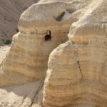
View the Scroll Caves from Afar
While the caves themselves are off-limits to visitors, you can view their dramatic entrances in the nearby cliffs. Seeing them in context makes the story of the scrolls’ discovery all the more real.
Ein Gedi – Oasis of Life in the Judean Desert
Site 3
Between the rocky cliffs of the Judean Desert and the salty waters of the Dead Sea lies Ein Gedi, one of Israel’s most remarkable natural and historical treasures. This lush oasis, with its year-round springs and green vegetation, has drawn people for thousands of years — from biblical figures to modern-day travelers.
Ein Gedi is closely linked to the biblical story of King David, who sought refuge here while fleeing from King Saul. As told in 1 Samuel 24, David hid in the caves of Ein Gedi, and it was here that he famously spared Saul’s life, choosing mercy over revenge. The cliffs, ravines, and caves that surround the oasis still evoke the tension and humanity of that moment. Walking these paths today, visitors step into a landscape where biblical history, spiritual reflection, and the raw beauty of the desert come together.
The oasis is also home to Ein Gedi Nature Reserve, a protected area where waterfalls, springs, and desert wildlife flourish in surprising abundance. Ibex and rock hyrax roam freely, while trails wind through striking canyons lined with reeds, palms, and freshwater pools. Nearby ruins, including an ancient synagogue with a beautifully preserved mosaic, reveal the life of a thriving Jewish community that once lived here over 1,500 years ago.
Ein Gedi is a rare meeting point of desert silence, biblical memory, and natural vitality — a place to reflect, explore, and experience the miracle of life in the wilderness.
What to See & Do:
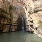
Hike Nahal David (Easy to Moderate, 1–2 hours)
The most popular trail in the Ein Gedi Nature Reserve. A scenic and relatively short walk along a flowing stream leads to the David Waterfall, passing shaded pools, lush vegetation, and occasional wildlife such as ibex and rock hyrax. Optional side paths offer views over the desert or access to higher springs and caves.
Explore Nahal Arugot (Moderate to Challenging, 2–4 hours)
A longer and quieter hike through a wide canyon with natural pools, waterfalls, and opportunities to wade through water. This trail offers a deeper and more adventurous experience of the reserve, ideal for visitors looking for fewer crowds and more immersion in the desert landscape.
Visit the Ancient Ein Gedi Synagogue
Located outside the nature reserve in the Ein Gedi settlement, this 3rd–6th century synagogue features a beautifully preserved mosaic floor with inscriptions that reveal the spiritual and social life of the ancient Jewish community that once lived here.
Ask at the Nahal David Entrance About Other Sites
For those interested in additional hikes or archaeological sites, such as the Chalcolithic Temple or Ein Gedi Spring and the surrounding ancient agricultural remains, we recommend asking the rangers or visitor staff at the entrance for up-to-date guidance and trail conditions. Some areas may require extra walking, climbing, or may only be accessible on certain routes.
Visitor Tips
Footwear: Bring shoes suitable for walking through water — especially if you plan to hike in Nahal Arugot or enter any of the natural pools.
Clothing: Wear lightweight clothes that dry easily, and consider bringing a change of clothes or bathing clothes if you plan to enjoy the waterfalls and wading areas.
Water: The desert heat can be intense — carry plenty of drinking water, especially in the hotter months.
Timing: Arrive early in the day to avoid heat and crowds, and check seasonal opening hours with the Nature and Parks Authority.
Jericho – Where History, Legend, and Landscape Meet
Site 4
Leaving behind the hills and intensity of Jerusalem, there’s a noticeable shift — not just in temperature, but in mood. As you drive eastward, the air warms and the landscape opens. After only a short time, you descend below sea level, watching the terrain turn dry and dramatic.
The road winds through the Judean Desert, flanked by rocky hills, modern villages, and scattered clusters of Bedouin life — semi-nomadic communities living much as they have for generations. You pass the sea level sign, and soon the glimmer of the Dead Sea appears ahead. Off to your left, in the wide Jordan Valley, lies Jericho — the world’s oldest and lowest city, nestled in a green patch of history and legend.
After a short ride through the modern-day Arab town of Jericho, we park by our destination: Tell Jericho — the ancient mound where Joshua’s story meets archaeology. The parking area, with its small restaurant and shade, is part of the experience when visiting Jericho — but for now, we’ll focus on exploring the site itself.
According to the Book of Joshua, this is where the Israelites marched around the city walls until they miraculously fell. Over the last century, archaeologists have studied the site in search of traces that match the biblical account. In the 1950s, Kathleen Kenyon led an influential excavation while the site was under Jordanian control. Kenyon, who was known for challenging biblical narratives at other sites as well, concluded that the destruction didn’t match the biblical timeline — a view that sparked decades of debate. But many other archaeologists, both before and after her, have argued the opposite. They not only pointed to collapsed walls, burnt layers, and pottery that fit the biblical description, but also questioned the dating methods and tools Kenyon used to reach her conclusion. Remarkably, the remains of the city walls appear to have fallen outward — a rare pattern that fits the dramatic verse: “The wall fell down flat, so that the people went up into the city, every man straight before him” (Joshua 6:20). Whether seen through the lens of faith, archaeology, or both, standing on this ancient mound connects you to one of the most iconic moments in biblical history.
More broadly, as more and more biblical sites are excavated across the region, a remarkable pattern has emerged: the stories in the Bible often align with archaeological evidence in ways that are too precise to ignore — making the biblical narrative not only spiritually compelling but historically credible.
After exploring the remains of the walls of Joshua — located just a few meters to the left as you enter the site — follow the stairs leading up to the top of the mound. If possible, take a moment in the shaded area to look out and imagine the ancient city that once stood here. This is where you can find and explore much more of Jericho and the surrounding areas.
Standing on top of the mound, with your face to the east, you can see the mountain ridge across the Jordan — including Mount Nebo, the place where Moses stood and looked out over the Promised Land.
Jericho was the first city the Israelites conquered on their journey from Egypt to the Promised Land — part of an incredible drama that began generations earlier, when Joseph was sold by his brothers, the sons of Jacob, setting into motion one of the greatest stories ever told.
This great story gave rise to the Passover — the central celebration of Jewish tradition — and later echoed into another powerful moment: the Last Supper in Jerusalem.
This is also where we encounter one of Jericho’s most remarkable claims: not only a biblical landmark but a cradle of human civilization — with remains dating back over 10,000 years.
What to See & Do:
Tel Jericho: Where History Began
A visit to Jericho begins with the ancient mound itself — Tel Jericho — where the remains of collapsed walls, stone towers, and early urban planning offer a window into both biblical drama and early human civilization. Just a few meters to the left after you enter the site, you’ll find the area traditionally associated with Joshua’s conquest. Follow the stairs up the mound and, if possible, pause in the shaded spots to take in the landscape and imagine the layers of history beneath your feet.
Mount of Temptation and the Monastery
From the top of the mound, you’ll notice much more than archaeology. To the west rises the rugged slope known as the Mount of Temptation — the traditional site where Jesus was tempted in the wilderness. High on the cliff face is the Greek Orthodox Monastery of the Temptation, built into the rock, accessible either by a steep hike or via the cable car from modern Jericho below.
Desert Caves and Ancient Solitude
Scattered across the slopes around the monastery are ancient desert caves, once inhabited by monks and hermits who sought solitude in the Judean wilderness. Their presence adds another layer of spiritual depth to this already sacred landscape.
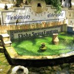
Elisha’s Spring: The Source of Life
Just a short walk from the ancient mound lies Elisha’s Spring, the freshwater source that has sustained Jericho’s continuous habitation for thousands of years. According to biblical tradition, it was here that the prophet Elisha purified the waters, making them sweet and life-giving (2 Kings 2:19–22). Today, the spring still flows, surrounded by palm trees and gardens — a peaceful spot that offers both historical depth and a moment of quiet refreshment.
Zacchaeus and the Sycamore Tree
Back in the modern town, don’t miss a stop by the ancient sycamore tree, traditionally identified as the one Zacchaeus climbed in the New Testament to catch a glimpse of Jesus as he passed through Jericho.
Rest, Shade, and a Camel Ride
Back at the base of the mound, the parking area itself offers a relaxed and shady spot to begin or end your visit. With palm trees and a few quiet places to sit, it’s a good opportunity to take a breath and soak in the atmosphere. Don’t be surprised to see a local Bedouin with his camel, offering short rides and photos — a reminder that this place is very much alive and not just a relic of the past.
The Temptation Restaurant Experience
The parking area is also part of a place with a fitting name: The Temptation Restaurant. Many times, while guiding groups here, I found myself “struggling” to get everyone to leave the comfort of the shade and the photo ops — as if the parking itself was the highlight. If the timing works, we’d often stop here for a meal. The first floor offers self-service in a modern-style setting with Arab flavors. But if you’re up for something special, ask for Walid near the entrance — the best host I’ve ever met. If you mention that a tour guide who knows you sent you, he just might spoil you with a few unforgettable dishes.
Bethlehem: City of David and Birthplace of Jesus
Site 5
Bethlehem today is a Palestinian town surrounded by smaller communities, just a short drive south of Jerusalem. Its main focus for visitors is the Church of the Nativity, the traditional place of Jesus’ birth, but a visit can also include other sites depending on your interests or your Christian tradition—whether Catholic, Orthodox, or Protestant.
In the Old Testament, Bethlehem is where Ruth the Moabite met and married Boaz (Ruth 1–4), a story of loyalty and redemption that unfolds in its surrounding fields. It was here that their great-grandson, King David, was born and anointed (1 Samuel 16), marking the town as the cradle of Israel’s most celebrated monarch and the seat of the House of David.
In the New Testament, the story begins with Joseph and Mary, and the census (Luke 2:1–5) that required them to travel from Nazareth to Bethlehem. Joseph’s family line traced back to the House of David, making Bethlehem—David’s city—their ancestral home and the place where, according to the Gospels, Jesus was born (Matthew 2; Luke 2), fulfilling the prophetic words of the Hebrew Scriptures (Micah 5:2).
While the Church of the Nativity stands as one of Christianity’s most revered sites, historical evidence directly connecting it to the actual birthplace of Jesus is lacking for the first three centuries after the events described in the Gospels. This gap contrasts with some locations in Jerusalem or Capernaum, where archaeological and textual evidence offers a closer link to the biblical period.
Given the circumstances of the time, it would have been difficult to trace the exact movements of two villagers from Nazareth and preserve the precise spot. Nevertheless, this does not mean that the events recorded in the Gospels are untrue, but rather that the physical location’s identification rests on tradition rather than continuous evidence.
What to See & Do:
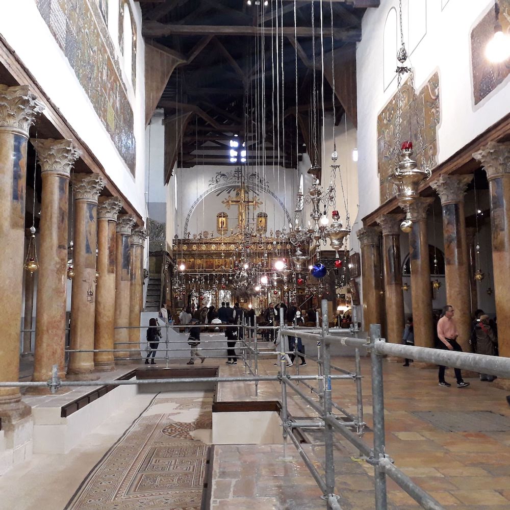
The Church of the Nativity
The Church of the Nativity is considered the oldest church in continuous use in the Christian world, making a visit here not only a journey to a holy site but also to a landmark of world history. Recognized as a UNESCO World Heritage Site and recently renovated, it holds a special status as a place shared by three Christian denominations—Greek Orthodox, Armenian Apostolic, and Roman Catholic—each maintaining its own traditions within the same sacred space.
There are many interesting details to explore in the church itself, like ancient mosaics, chapels, and historical architecture, but the main attraction is the silver star set into the floor beneath the altar in a cave, marking the traditional spot of Jesus’ birth. To reach it, visitors descend a narrow staircase on the right side of the church; once down inside the Grotto, you will see the star under the altar on your right.
From my experience, many visitors expect to see something resembling the nativity scenes they know from home—images created by artists over the centuries, each shaped by the culture and traditions of their time. In reality, the site is a simple rock-hewn space, much like the caves that served as living and shelter areas in Bethlehem 2,000 years ago, making it more authentic to the era than most imagined depictions.
Visiting Tips for the Church of the Nativity
Tour buses must park in the paid lot about 15 minutes’ uphill walk from the church. Only private tours with special arrangements through a travel agent or a large souvenir shop can drop closer. In high season, the wait to enter the Grotto can be 1–3 hours, and visitors are given only a few seconds at the silver star under the altar (mainly significant for Catholic and Greek Orthodox pilgrims; many Protestants prefer to skip the wait).
Saint Catherine’s Church
Located right next to the Church of the Nativity and connected to the same underground cave system. From here, you can access a section of the Grotto without standing in line (though you can’t touch the star). Guiding Protestant groups for decades, I’ve found this route always appreciated, as it offers a quieter and more authentic-feeling part of the cave—enough to give visitors the sense that they’ve truly been there, satisfied by experiencing the atmosphere of the sacred site without enduring the long wait and crowds.
Milk Grotto
Located a short walk from the Church of the Nativity, the Milk Grotto is a peaceful site where, according to tradition, Mary nursed the infant Jesus. The white-colored stone in the cave is said to have absorbed a drop of Mary’s milk, giving the grotto its name. It is especially popular with Catholic and Greek Orthodox pilgrims, who visit for blessings, prayer, and reflection.
Shepherds’ Fields
Just outside Bethlehem, these fields commemorate the angels’ announcement to the shepherds about Jesus’ birth. Some of the chapels are built within caves that were historically used to shelter sheep at night, giving visitors a sense of the landscape and life of the shepherds. The main church was designed by the renowned Italian architect Antonio Barluzzi, who built several important holy sites in the Holy Land.
Shops and Food
Bethlehem has large shops selling local olive-wood crafts, a traditional industry of the town, as well as some nice restaurants serving local food. Ask your guide or travel agent for recommendations to make the most of your visit.
Herodium: Palace, Fortress, Tomb
Site 6
One of the most stunning sites near Bethlehem and just a short drive from Jerusalem, Herodium (Herodum) rises as a striking cone on the edge of the Judean Desert. And if you want to add a layer of understanding about Herod the Great — to see not only the name of a king mentioned in the Scriptures but also the scale of his ambition and legacy in stone — this is a must. According to the historian Flavius Josephus (Antiquities 14.360–361), it was here in 40 BCE that Herod fought a desperate battle against the Hasmonean and Parthian forces, nearly defeated before turning the tide to victory. Later, in The Jewish War (1.419–421), Josephus records how Herod built Herodium as a fortified palace to commemorate that triumph. Professor Ehud Netzer — archaeologist and architect — argued that this dramatic survival explains why Herod later reshaped the hill into his palace-fortress and eternal monument. From its upper towers to the lavish lower palace, gardens, pools, and hippodrome, Herodum remains both a triumph of ancient engineering and a symbol of royal ambition carved into the desert landscape.
Herodium is also unique in another way: it is the only building project that bears Herod’s own name. More than just a palace or fortress, this site became his chosen tomb monument. Josephus (Jewish War 1.673) tells how Herod’s funeral procession brought him here to be buried, and after decades of searching, Professor Netzer discovered the remains of his mausoleum on the slope of the hill — fragments of a grand tower-like structure and royal sarcophagi. In this way Herodium became not only the stage of Herod’s victory but also the place of his final rest, a lasting monument to the king who built it.
What to See & Do:
Visitor Center, Introductory Film, and Model
Begin your visit at the on-site visitor center, where a short film introduces the history of Herodium and King Herod’s remarkable building project. A detailed scale model of the site provides orientation before you set out, helping you understand the scale and layout of the fortress-palace on the mountain above. You can always ask the staff here for advice on the best way to plan your visit.
Getting Up to the Fortress
You can either climb directly up the slope to the summit for breathtaking panoramic views, or take the path that first leads to Herod’s tomb and the monumental staircase ascending to the fortress entrance. Both routes allow you to appreciate the dramatic setting of Herodium and the unique vision behind its construction.
Staircases and Entrance to the Palace-Fortress
As you make your way up the slope past Herod’s tomb, you’ll encounter the monumental staircases that once formed the grand approach to the fortress. These steps served as the ceremonial processional route leading directly into the heart of the stronghold.
The Courtyard and Palace Complex
At the top lies the vast central courtyard, which formed the core of daily life in the fortress. Here you can explore the remains of the grand reception hall, the synagogue adapted during the Great Revolt, a Roman-style bathhouse, a small Byzantine chapel, several large cisterns, and the eastern tower. The entrance to the underground tunnels is also located here. Originally carved for water storage and later expanded during the Bar Kokhba Revolt, these tunnels provided a hidden escape route. Today, walking through them leads you back toward the theater area on the slope.
The Theater and Royal Chamber
A small theater with a royal chamber was built here to entertain Herod and his special guests. One of the most prominent visitors was Marcus Agrippa, Rome’s powerful statesman and close ally of Emperor Augustus, who came to Herodium in 15 BCE. Agrippa had commanded the Roman fleet at the decisive naval battle of Actium in 31 BCE, where Augustus’ forces triumphed over Mark Antony and Cleopatra. His presence at Herodium underscored not only Herod’s loyalty, power, and diplomacy, but also the uniqueness of the site itself — a fortress-palace unlike any other in the region, blending monumental architecture with innovative design. Today, the theater comes alive with an interactive show, allowing visitors to experience the architecture, design, and royal atmosphere that once made Herodium extraordinary.
Tel Lachish Map & Tour
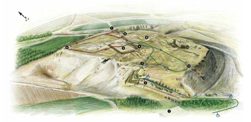
Visitor Center
City Gate
Inner gate
Palace courtyard and thrones
The palace
View of the Fosse Temple
Well
Christ-thorn jujube tree
The Solar Shrine
The quarry (the Great Shaft)
Glacis
Assyrian siege ramp
Tel Lachish
Site 7
If you are touring the classic sites of Israel and are drawn to the dramatic stories of the Bible, Lachish offers a unique window into history you can see with your own eyes. Located in the Shephelah, on the road from the coastal plain to the Hebron Hills, this site is easy to include if you have some spare time during your tour or are planning a route through southern Judah. As you approach Tel Lachish, you are stepping into the very heart of ancient Judah’s agricultural landscape. Driving toward the site, you’ll see fields full of vineyards, just as they were in the days of the Tribe of Judah.
The Biblical Drama of Lachish
The Biblical Drama of Lachish
In the late 8th century BCE, King Hezekiah of Judah made a bold choice. Refusing to continue paying tribute to the Assyrian empire, he sought independence for his kingdom. He forged alliances with Philistia and Egypt, hoping to resist Assyrian control and prevent Judah from being reduced to just another Assyrian province.
The Assyrian king Sennacherib responded with overwhelming force. In 701 BCE, he launched a campaign against Judah, capturing one fortified city after another. The Bible records:
“Now in the fourteenth year of King Hezekiah, Sennacherib king of Assyria came up against all the fortified cities of Judah, and took them.” (2 Kings 18:13)
Among these cities was Lachish, Judah’s second most important stronghold after Jerusalem. Because of its strategic position on the road to Egypt, it was heavily fortified. Yet even its massive walls and glacis could not withstand the might of Assyria.
The Assyrian army constructed a huge siege ramp against the city wall — the earliest known example in the world. From there, they brought up battering rams while volleys of arrows darkened the sky. Archaeologists found hundreds of Assyrian arrowheads on the site, along with heavy objects thrown down by Lachish’s defenders in a desperate attempt to repel the attackers.
The battle was fierce, but the city fell. Sennacherib himself celebrated the victory with monumental stone reliefs in his palace at Nineveh, vividly depicting the conquest of Lachish, the deportation of its people, and the spoils of war. These reliefs remain one of the most important visual sources for the history of the Bible.
From his camp at Lachish, Sennacherib sent forces against Jerusalem. The city stood on the brink — but unlike Lachish, it was not taken. The Bible describes how, after Hezekiah prayed and the prophet Isaiah gave his reassurance, the Assyrian siege was suddenly lifted:
“That night the angel of the Lord went out and struck down 185,000 in the camp of the Assyrians.” (2 Kings 19:35)
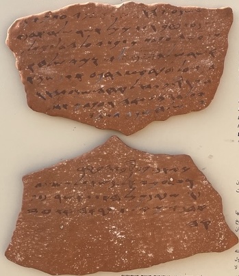
Lachish did not rise again to its former glory. A century later, during the Babylonian invasion (586 BCE), the Lachish Letters — inscribed pottery fragments written by soldiers and commanders — bear witness to Judah’s final days. One famous letter records the desperate situation:
“We are watching for the fire signals of Lachish… for we cannot see Azekah.”
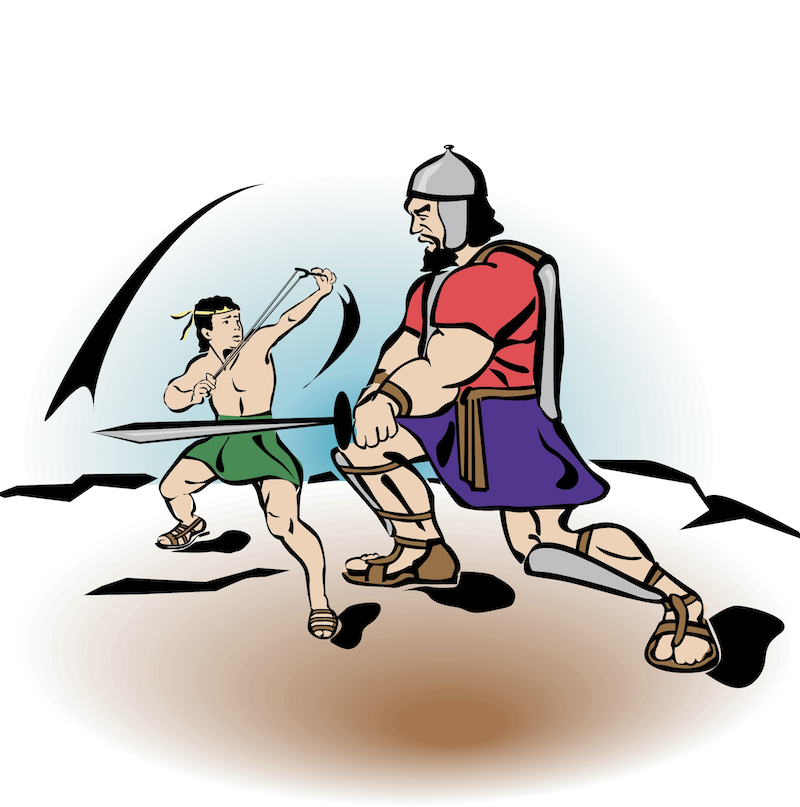
This suggests that Azekah, a neighboring Judahite city in the Shephelah not far from Lachish, had already fallen, leaving Lachish as one of the last outposts before Jerusalem itself succumbed. The area around Azekah is also tied to another dramatic biblical moment: the Valley of Elah, at its foot, is the very place where David faced Goliath in single combat (1 Samuel 17).
What to See & Do:
The Visitor Center
After arriving and parking at the entrance, begin your visit at the visitor center. Here you’ll find a small exhibition with copies of the monumental stone reliefs from King Sennacherib’s palace at Nineveh, vividly depicting the Assyrian conquest of Lachish. Seeing these images first helps anchor the story in your mind before you set foot on the mound itself.
From the visitor center, follow the trail uphill toward the ancient city. As you walk past the remains of massive fortifications, imagine the scene described in the Bible: the Assyrian army laying siege, archers loosing their arrows, and the city’s defenders desperately holding the walls.
The City Gate Complex
As you approach the main city gate, you enter what was once the heart of Lachish — both defensively and socially. The gate was a massive, multi-layered structure, designed to protect the city while controlling access. Soldiers patrolled the towers, while merchants, judges, elders, and even prophets conducted the business of the city in the open plaza between the inner and outer gates. Its design also forced approaching soldiers to expose their unshielded side, making the gate a strategic point in both defense and daily life.
Within the gate, archaeologists uncovered a small shrine, a cultic chamber where offerings may have once been made. The shrine had been deliberately defaced during Hezekiah’s religious reforms: its altars were smashed, the horns cut off, and in the innermost chamber, they discovered a stone seat with a hole — a symbolic toilet. Although never intended for actual use, its placement was a clear act to render the shrine impure and unusable for worship. This rare archaeological find mirrors the biblical account in 2 Kings 10:27, where a temple of Baal was turned into a latrine, and provides a tangible connection between the reforms described in the Bible and the material remains at Lachish.
The Siege Ramp
Climb higher and pause to look toward the southwestern slope. Here lies the dramatic remnant of the Assyrian siege ramp — the oldest known in the world. Picture Sennacherib’s soldiers piling stone upon stone to raise the ramp, dragging heavy battering rams toward the wall, while Lachish’s defenders rained down burning objects and stones. The arrowheads found here are silent echoes of the battle.
The Palace Fortress
At the top of the mound stood the palace fortress, seat of Lachish’s governor and a center of royal administration. Though today only foundations remain, it once covered more than a hectare and featured courtyards, storerooms, and grand halls. Tradition recalls that King Amaziah fled here after a rebellion in Jerusalem — only to meet his end within these walls. From this vantage point, you’ll see why Lachish was the most important city of Judah after Jerusalem.
The City and Daily Life
Beyond the palace, the slopes were crowded with simple houses, workshops, and courtyards. Excavations revealed ovens, storage jars, and benches used by ordinary families. Yet in many homes, arrowheads embedded in floors and walls bear witness to the violence of the Assyrian assault that ended daily life here.
The Water System
Although less visible to visitors, Lachish also boasted a sophisticated water system, designed to secure supplies during a siege. Channels and reservoirs were uncovered underground, a reminder of the city’s resilience in the face of war.
The Lachish Letters
In one of the rooms at the site, archaeologists discovered about 20 inscribed potsherds (ostraca) written in ancient Hebrew, dating to the years just before the Babylonian invasion in the early 6th century BCE. These letters record urgent correspondence between military officers in Judah.
One of the most famous, Letter IV, reads:
“… we are watching for the fire signals of Lachish according to all the signs which my lord has given, because we cannot see Azekah.”
This line captures the desperate final days of Judah — with Lachish standing as one of the last strongholds.
The Battle of David and Goliath
Site 8
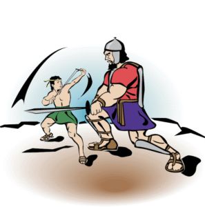
If you are exploring the Shephelah region—once part of the territory of the tribe of Judah—or driving south toward sites like Lachish, you may want to pause here for a short stop. A short walk from the main road brings you into Nahal HaElah (the Elah stream), where you can still find small smooth stones that fit perfectly with the biblical story. On Route 38 near Route 375, about 30–40 minutes from Jerusalem, tradition places one of the Bible’s most iconic events: the battle between David and Goliath. Here, the Philistines challenged King Saul’s army until young David of Judah, chosen by God to be Israel’s future king, defeated the giant warrior with just a sling and a single stone.
It’s interesting to think about how God chose His leaders in the Bible. Saul, from the smallest tribe of Benjamin, became Israel’s first king. David, the youngest son and a shepherd from Judah, was chosen to face Goliath. Centuries later, Jesus came from Nazareth, a small, humble village in the Galilee. Time and again, greatness arose from the least expected places.
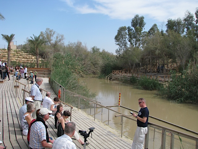
Qasr al Yahud The Authentic Baptism Site
Site 9
If you have some spare time, even if you already visited Yardenit, it is worth coming to Qasr al Yahud, the actual historical location of several important biblical events. While many Christian pilgrims use Yardenit as a modern baptism site with cleaner water and better facilities, the real setting of the New Testament stories took place here near Jericho.
Qasr al Yahud is known as the place where Jesus was baptized by John the Baptist, as described in Matthew 3. It is also remembered as the area where the Israelites crossed the Jordan River when they entered the Land of Israel under Joshua, in Joshua 3–4. Some traditions also connect this area to the early life and activity of John the Baptist because the desert environment, the simple lifestyle, and the call for repentance remind many researchers of the way of life practiced by the community at Qumran. While there is no proof that John lived with them, the location and the spiritual atmosphere of the region help explain why this tradition developed.
The Significance of the Baptism of Jesus
The baptism of Jesus by John is one of the most meaningful moments in the New Testament. It marks the beginning of Jesus public ministry and symbolizes humility, spiritual preparation, and renewal. According to the Gospels, this is the moment when the heavens opened and a voice declared Jesus as my beloved son, which makes this location especially important for Christian visitors.
The Jordan River Past and Present
In ancient times, the Jordan River in this area carried a much stronger and faster flow as it made its way to the Dead Sea. Over the years, as water has been diverted for agriculture and local communities, the river has become narrower and calmer than it once was. Even so, the atmosphere here remains powerful and very authentic.
A Borderland of Faith
Because this location sits right on the border between Israel and Jordan, visitors can easily see chapels, baptism platforms, and pilgrims on both sides of the river, sometimes only a few meters apart. This closeness adds to the unique atmosphere of the place.
Although the facilities here are simpler compared to Yardenit, Qasr al Yahud offers something very special: a genuine and natural connection to the biblical landscape and the feeling of standing exactly where these events took place.
Wild Life
The Judean Desert and Dead Sea region is home to a rich variety of wild animals, uniquely adapted to the desert and rocky terrain. Here’s a glimpse of some you might encounter on your journey through this extraordinary landscape.


