When I stand on a mountain overlooking the Sea of Galilee, I am struck by how little this landscape has changed. The world and ministry of Jesus unfolded here, in real towns and along shorelines still part of everyday life. After guiding groups here for decades, I see the Sea of Galilee as one continuous story, where Scripture, history, and the present exist side by side. Whether traveling alone or leading a group, these names are not just words on a page, but places you can walk, see, and touch. This interactive map invites you to explore biblical settings, historical sites, and scenic routes, and discover the living connection between the Word, the land, and life today.
The Sea Of Galilee
Mt.Beautitudes
Capenaum
Tabgha
Mensa Christi
Capernaum: Greek Orthodox
The ancient boat
Kursi
Sussita
Kibbutz Degania
Ancient Korazim
Mount Arbel
Gamla
The Horns of Hattin
Hamat Gader
Semakh Railway Station
Magdala
Tiberias
Griffon vulture

boat ride
A boat ride on the Sea of Galilee is a meaningful experience for many Christians, offering a chance to reflect on the miracles and ministry of Jesus.

Yardenit
Yardenit is a popular baptismal site on the Jordan River.It is a significant place for Christians who come to renew their faith through baptism.
The Sea of Galilee, also known as Lake Tiberias or Kinneret in Hebrew, is a freshwater lake renowned for its diverse marine life, and various species of fish, including the famous St. Peter’s fish, which holds significance in Christian tradition. According to biblical accounts, Jesus Christ walked on the waters of the Sea of Galilee, demonstrating his miraculous powers to his disciples. Situated approximately 215 meters below sea level, the Sea of Galilee serves as a vital water source for the surrounding region. It acts as a natural reservoir, receiving water from the Jordan River and feeding into the Dead Sea, making it a crucial component of the area’s hydrology and ecosystem.
On a hilltop just a short distance from the shoreline, you can easily identify a beautiful chapel hidden among the eucalyptus trees. This is the traditional site of the Mount of Beatitudes, where the Gospels tell us Jesus delivered the Sermon on the Mount (Matthew 5–7).
Now, can we be sure that we are standing on the exact physical spot where Jesus stood? Probably not. When the church was built in 1937, it was placed on a quiet, empty hilltop, based on traditions passed down through generations.
But even if we are not at the precise coordinates, it does not mean the events did not take place somewhere nearby. Standing on the summit, one might even wonder whether a hilltop is the best place to be heard by a large crowd. It is far more likely that Jesus stood on the side of the hill, using the slope as a natural Greek theater, where the people could sit above him and his voice could carry clearly to everyone.
However, maybe there is a meaningful symbolic connection here that helps explain why the church was built on the top of the hill. Just as Moses ascended Mount Sinai to receive the Law, Jesus is presented here as the “New Moses” teaching on a mountain. While the crowds sat on the slopes to listen, the church stands at the peak as a reminder of this fulfillment, where the Law given in the desert meets the grace shared here in Galilee.
The site is owned by the Vatican and maintained by the Franciscan Sisters. The church you see today was designed by the renowned architect Antonio Barluzzi. Its eight-sided structure honors each of the Beatitudes, creating a space that links the ancient Word with the surrounding landscape.
The site is usually open from 8:00 to 12:00 and 14:00 to 17:00. During the high season, many tourists begin their Galilee visits here, so it can sometimes be crowded. For special events or holidays, it’s best to check in advance.
Capernaum was a Jewish town on the shores of the Sea of Galilee, located along the ancient Via Maris, the main trade route linking Egypt with Syria and Mesopotamia. It developed as both a fishing village and a small trade center. In the early 1st century CE, following the division of Herod the Great’s kingdom, Capernaum lay near the border between the territories of two of his sons—Herod Antipas, ruler of Galilee, and Herod Philip, ruler of the northeastern regions.
The site is best known today for its role in the New Testament. Capernaum became the center of Jesus’ ministry after he left Nazareth, where many of his teachings and miracles took place. Several of Jesus’ disciples, including Peter, Andrew, James, and John, came from Capernaum. Archaeological remains include the ruins of a synagogue built on earlier foundations where Jesus is said to have taught, as well as homes, providing a glimpse into the town’s evolution over time. The traditional site of the house of the Apostle Peter, later transformed into a church, is considered one of the closest archaeological links to the historical Jesus.
Like many other towns without continuous habitation, Capernaum eventually became piles of ruins, covered by dust and sand, and was largely forgotten until the 19th century. In 1866, British explorer Charles William Wilson identified the site. In 1894, the Franciscans acquired part of the area, conducted excavations, and built protective walls and a monastery. Today, Capernaum is a major pilgrimage and tourist site, preserving the memory of its biblical significance.
Tabgha in Christian tradition is the site of several miracles performed by Jesus, notably the multiplication of loaves and fishes. The name “Tabgha” is derived from the Greek word “Heptapegon,” meaning “seven springs,” a reference to the natural springs that flow in the area. One of the most prominent landmarks in Tabgha is the Church of the Multiplication, built on the site where Jesus is believed to have performed the miraculous feeding of the multitude. This Byzantine-era church features intricate mosaics depicting scenes of biblical significance, including the miracle of the loaves and fishes.
Mensa Christi, meaning “Table of Christ” in Latin. According to tradition, it is the place where Jesus appeared to his disciples after his resurrection and shared a meal with them. The site is marked by a small chapel, known as the Church of the Primacy of Saint Peter, which is built atop a rock formation believed to be the place where Jesus and his disciples gathered for this meal.The church’s name reflects the biblical account in which Jesus instructs Peter to “feed my sheep,” symbolizing Peter’s role as the leader of the early Christian community.
Most visitors to the northern shore of the Sea of Galilee include four main sites in their itinerary: the Mount of Beatitudes, Tabgha (Church of the Multiplication), Mensa Christi (Church of the Primacy of Peter), and Capernaum. Because most tour groups leave their hotels at roughly the same time in the morning, the sites tend to become crowded very quickly. Many groups begin at the Mount of Beatitudes, which often leads to parking congestion and a less intimate experience. Tip from experience: consider starting your day at Capernaum instead. You are more likely to enjoy quieter moments, especially during the cooler morning hours. This is particularly helpful in hotter seasons, as Capernaum offers very little shade. While crowds can never be guaranteed, this approach often works well.
This historic church stands on the site believed to be where Jesus Christ taught and performed miracles during his ministry. The church’s significance lies in its association with the apostles, as Capernaum was a central hub for their activities following Jesus’ teachings. The church itself is characterized by traditional Byzantine architecture, adorned with ornate frescoes and religious icons that depict scenes from the life of Christ and the apostles.
The ancient boat in Ginosar, is a remarkable archaeological discovery dating back to the time of Jesus Christ. Excavated from the muddy shores of the Sea of Galilee, this well-preserved 2,000-year-old boat offers a fascinating glimpse into the maritime history of the region. Believed to have been used by fishermen during the time of Jesus, the boat provides insight into ancient boat-building techniques and daily life in biblical times. Visitors can marvel at this extraordinary artifact displayed in a climate-controlled museum, offering a captivating experience bridging the past with the present.
After many years of guiding travelers around the Sea of Galilee, I can say that Kursi is one of the least visited sites in the region. On the eastern shore of the lake, away from the more popular sites on the western side, it sits quietly and offers something different. Most group tours skip it because there are so many other places to see, even though it is very close to the main road and easy to visit.
The main attraction at Kursi is a fifth-century Byzantine monastery, including its well-preserved church, baptistry, and surrounding settlement. The church is notable for its state of preservation, which is rare for sites of this age around the Sea of Galilee — for example, at Capernaum you can see only the foundations of a church from the same period. Nearby Susita (Hippos) was a major town at the time, highlighting Kursi’s role as an important pilgrimage destination. Perhaps the most significant aspect of Kursi is that visitors can still see a well-preserved fifth-century church as part of a large monastery, allowing them to experience the scale and history of the site in a way that few other locations from this period do.
According to Christian tradition, Kursi is the site of the miracle of the swine described in the New Testament. The event appears in the Gospel of Matthew (8:28–34, NIV), the Gospel of Mark (5:1–20, NIV), and the Gospel of Luke (8:26–39, NIV).
In Luke’s account (NIV), the event takes place in “the region of the Gerasenes, which is across the lake from Galilee.” In the Bible, Galilee refers to the Jewish region on the western shore of the Sea of Galilee. “Across the lake from Galilee” means the eastern side of the lake, an area inhabited largely by Gentiles. This explains the presence of pigs, which would not have been raised in Jewish communities.
The Gospels describe how Jesus encountered a man possessed by many demons. After casting the demons out, he allowed them to enter a nearby herd of pigs. The herd then rushed down a steep slope into the Sea of Galilee and drowned. Although the name Kursi does not appear in the Bible, the site’s geography closely matches the description. A steep hillside descends directly to the shoreline, making it one of the few locations around the lake where such an event could realistically occur.
Caves higher up the slope above Kursi are associated with the detail that the possessed man lived among tombs or in isolated places. Archaeological remains also show a paved route leading down toward the shoreline, reflecting long-term movement between the hillside and the lake. The steep terrain and direct descent help explain the Gospel story, making it easy to imagine how a herd of pigs could rush into the water.
Under the eucalyptus trees at Kursi are a few simple stone benches, placed in an area that some visitors and researchers describe as having unusually high natural energy levels. Similar energy spots, sometimes called power places, are known in different parts of the world and are often linked to geology, underground water, or long-term human activity.
These locations are commonly discussed using bovis units, a traditional scale used in dowsing to estimate environmental energy. An average natural setting is often described as measuring around 6,500 bovis units. At Kursi, reported measurements range between 18,000 and 20,000 units, placing it well above the commonly cited baseline.
For comparison, sites such as Stonehenge in England are often reported in the range of 13,000 to 17,000 units, while areas near the Eiffel Tower in Paris are sometimes cited at around 12,000 to 14,000 units. These figures are not part of scientific measurement, but they are widely referenced in alternative and experiential traditions.
Whether approached with curiosity or simply enjoyed as a quiet pause, the shaded benches offer a calm moment to sit, rest, and experience the site from a different perspective.
A friend and longtime visitor to the region enjoying one of the energy benches at Kursi.
Susita is an exciting destination for anyone interested in archaeology, history, and landscape. Long neglected, the site has been gradually uncovered and prepared for visitors, offering a rare opportunity to walk through a once-powerful city overlooking the Sea of Galilee.
Susita, known in Greek as Hippos, is an archaeological site on a steep hill about 2 kilometers (1.2 miles) east of the Sea of Galilee. Founded in the mid-2nd century BCE as a Greek polis, the city stands on a naturally fortified hill surrounded by cliffs on all sides. The hill rises about 144 meters (472 feet) above the Sea of Galilee and is connected by a narrow saddle to the Golan Heights.
The city controlled wide areas east of the Sea of Galilee and was part of the Decapolis, a group of Greco-Roman cities in the region. The Gospels mention Jesus traveling and teaching in the region of the Decapolis (Mark 5:20; Mark 7:31; Matthew 4:25), placing Susita within the broader cultural and geographic setting of his ministry.
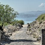
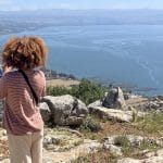
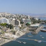
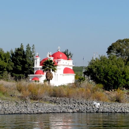
Susita had two harbors on the Sea of Galilee. The main ancient harbor was located near today’s Ein Gev, and its breakwaters can still be seen when the lake level is very low.
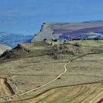
The name Susita is the Aramaic translation of the Greek name Hippos, meaning “horse.” One explanation links the name to the shape of the hill, which resembles a horse’s head and neck. In Arabic, the site is known as Qal‘at al-Husn, “Fortress of the Horse.”
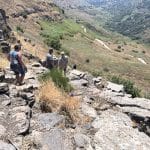
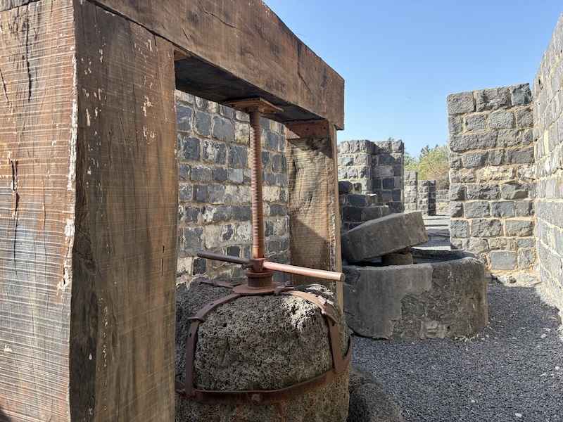
The city flourished during the Roman period. It featured temples, markets, a theater, bathhouses, fortifications, and a colonnaded main street. Water was supplied mainly by rainwater cisterns and later by a long aqueduct that brought water from the Golan Heights, reflecting the city’s prosperity.
In the Byzantine period, Susita became part of the province of Palestina Secunda. Christianity spread gradually, and the city later served as a bishopric with several churches. After repeated earthquakes, including a major one in the 8th century, the city was abandoned and never rebuilt.
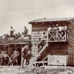
In modern times, the hill was used as a strategic military position. During Israel’s War of Independence, the site was captured and later served as an outpost of the Israel Defense Forces (IDF) until 1967. Remains of trenches, firing positions, and a supply cable system from Ein Gev can still be seen, along with a memorial at the western edge of the site.
What to See in Susita
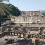
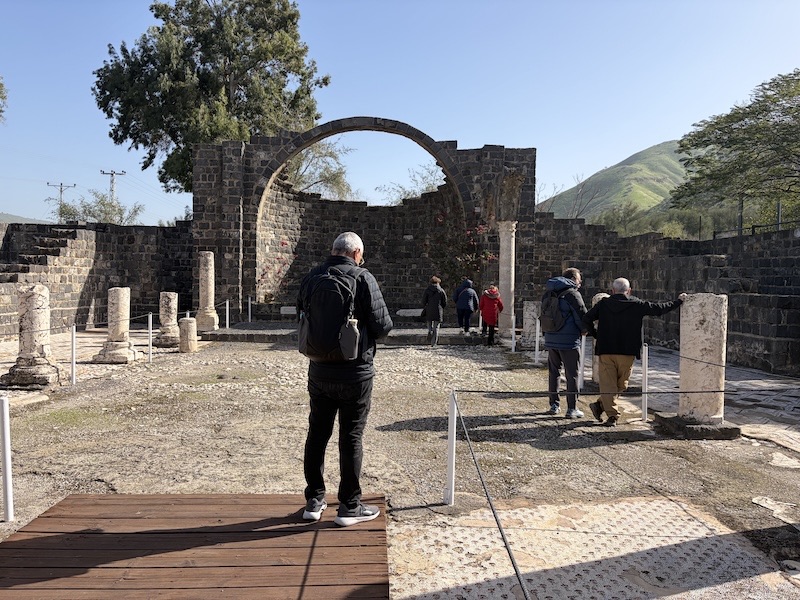
The Forum
The city’s heart, surrounded by colonnades, where public life, markets, and daily gatherings took place.
The Water Reservoir
A large underground reservoir fed by a 14 km (9 mi) aqueduct. Visitors can walk down into its vaulted limestone chamber.
The Basilica
A roofed public building near the forum used for social and administrative activities.
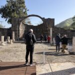
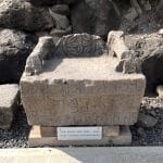
The Kalybe (Imperial Shrine)
A small cult building with a semicircular niche that once held a statue of the emperor.
The Central Bathhouse
An impressive public bath and courtyard complex.
The Odeon
A small roofed theater for intimate performances, showing the city’s connection to classical culture.
Churches
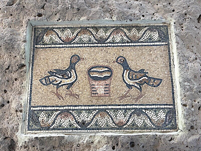
Eight churches were built in the city from the 5th century CE onward, offering a glimpse of Susita’s Byzantine Christian life.
A group of young, Zionist Jews with a shared dream ventured into the land south of the Sea of Galilee in 1910. Their goal: to build a self-sufficient Jewish community based on working the land together. This was Kibbutz Degania Alef, the very first kibbutz. The dream proved contagious. By 1920, just a bit south, Kibbutz Degania Bet was born. Sharing the same ideals of socialist agriculture and communal living, both kibbutzim faced harsh conditions and disease. Yet, their determination and innovation not only helped them survive but thrive. Together, these two kibbutzim stand as a testament to the pioneering spirit that shaped Israel’s development. While the kibbutz movement has evolved, their legacy lives on, a reminder of the collective courage that built a nation.
Ancient Korazim, perched on a plateau overlooking the Sea of Galilee, was part of a network of Jewish villages that developed in the Galilee following the Hasmonean expansion. The Hasmoneans were a Jewish ruling dynasty that emerged after the Maccabean Revolt (167–160 BCE), when Jewish rebels rose against the Greek Seleucid Empire to resist forced Hellenization and defend their faith. They established an independent kingdom in the Land of Israel, strengthening Jewish life in regions like the Galilee. The area continued to flourish into the Roman period, with a vibrant population living from agriculture, trade, and local craftsmanship.
Today it is an archaeological park, where the remains of daily life can still be seen, including a well-preserved synagogue built of dark basalt stone. Among its notable features are the decorated stone carvings and a raised seat, traditionally called the “Seat of Moses,” used for reading the Torah and teaching. The town is also mentioned in the New Testament, in the Gospels of Matthew (11:20–24) and Luke (10:13–15). According to the Gospels, Jesus taught and performed miracles here. Although the town did not respond as expected, these events are recorded as part of his message. This gives Korazim a unique place in the biblical account, where the words and presence of Jesus are still remembered.
Cradling the Sea of Galilee with its dramatic cliffs, Mount Arbel is a haven for history buffs and nature lovers alike. Carved into the mountainside are natural caves that served as Jewish dwellings for centuries. However, these caves gained notoriety during a tumultuous period. Herod the Great, facing rebellions, sought to crush any opposition. The caves on Mount Arbel became a refuge for these rebels, but Herod’s forces were relentless. The famous historian Josephus Flavius, in his book Jewish Antiquities (Book 14, Chapter 420 and following chapters), recounted the dramatic siege, including the legendary story of Herod’s soldiers being lowered in crates to capture the well-fortified caves. Today, the park offers a chance to explore these caves, hike scenic trails, and soak up the breathtaking views, a place where history and nature collide.
Gamla, nestled on the edge of a cliff overlooking the Sea of Galilee, offers a thrilling blend of history and nature. Its story stretches back centuries. Once a bustling Jewish city, it became a crucial rebel stronghold during the Great Revolt against the Roman Empire, which erupted in 66 CE. Imagine the fierce battles fought here as Jewish defenders bravely resisted the Roman siege. The historian Josephus Flavius, in his book “The Jewish Wars,” documented these dramatic events. Today, Gamla is an archaeological treasure. A challenging hike leads you to the ruins, where you can wander through the remains of synagogues, houses, and fortifications. Picture daily life unfolding within these ancient walls.
But Gamla isn’t just about history. The panoramic views of the Sea of Galilee are breathtaking. You might even spot majestic Griffon vultures soaring overhead. Gamla offers a unique experience: historical significance, stunning scenery, and a touch of adventure for those willing to make the climb.
At the Horns of Hattin, a pair of unforgiving hills in Israel, a crucial battle unfolded in 1187. The Crusaders, led by King Guy of Jerusalem, marched to confront Saladin’s Muslim forces. But disaster struck. They chose a scorching summer route, baking under the sun with dwindling water supplies. Saladin, a brilliant strategist, saw his chance. He surrounded the Crusaders, cutting them off from water and relentlessly harassing them with his lighter troops. Exhausted and demoralized, the Crusaders crumbled. The battle became a rout, with many killed or captured, including King Guy himself.
The defeat at the Horns of Hattin was a turning point. Jerusalem soon fell to Saladin, significantly weakening Crusader control of the Holy Land. This battle stands as a reminder of the importance of strategy, leadership, and adapting to the environment in the face of war.
Hamat Gader’s allure stretches back millennia. Famed for its natural hot springs, known for their therapeutic qualities since Roman times, it’s a haven for relaxation. Step back in time and explore the impressive remains of the second-largest Roman bath complex in the entire empire. Beyond the baths, the site boasts a rich history, with remnants of Roman buildings, and a synagogue, offering a glimpse into this bygone era. The synagogue, unearthed on the mound south of the baths, dates back to the 5th-6th century and is believed to have served the many Jews who came to the baths. Fast forward to today, a water park and a crocodile farm provide thrills for all ages. And to top it off, the stunning scenery of the Sea of Galilee and Golan Heights creates a picturesque backdrop for this unforgettable escape.
The Semakh Railway Station, a remnant of Israel’s past, whispers tales of trade, war, and travel. Built in 1905 by the Ottoman Sultan, it served as a vital stop on the vast Hijaz Railway, connecting Damascus to Medina. Goods and people flowed through this bustling hub, linking Palestine, Jordan, and Syria during the early 20th century. Semakh’s location near the Sea of Galilee and crossroads of territories made it strategically significant. It witnessed battles during World War I and Israel War of Independence in 1948.
Today, the station stands silent, its tracks no longer carrying passengers. However, restored as a visitor’s center, it offers a glimpse into the history of the “Valley Train” and the Semakh station’s role in the region’s development. The surrounding landscape adds to the experience, with the beauty of the Sea of Galilee offering a scenic backdrop.
In the Gospels, the Sea of Galilee is where Jesus calmed a storm — a moment of divine power witnessed by his disciples as they struggled in fear against the wind and waves. Nearly two thousand years later, those same waters challenged a very different kind of vessel: the flying boats of British Imperial Airways.
In the early 1930s, the British established a stopover near Tzemach, at the southern tip of the Sea of Galilee, as part of their long-haul air route from London to India. The tranquil surface of the lake offered an ideal landing site — at least in theory.
But reality proved more turbulent. Afternoon winds would suddenly whip across the water, making it difficult for the large aircraft to land or take off safely. Pilots reported dangerous wave conditions, and landings often drew crowds of curious locals, adding a bit of chaos to an already risky operation.
What began as a bold logistical choice soon turned into a weather-beaten struggle.
By the mid-1930s, the British abandoned the Galilee stop and redirected flights to Haifa, where better infrastructure and calmer conditions awaited. The brief chapter of flying boats on the Sea of Galilee faded into history — but it left behind a curious footnote in the region’s layered story.
Founded around 18-20 CE by Herod Antipas, son of the king Herod the Great, Tiberias has thrived for over two millennia. Herod Antipas, who ruled Galilee and Perea under the Roman Empire, established the city as his capital and named it after the reigning emperor, Tiberius. Over the centuries, Tiberias has transformed from a major Jewish center in Roman times to a prominent seat of Rabbinic scholarship. Today, it’s a popular resort town known for its natural hot springs, beautiful lakeside setting, and historical sites.
One such site is the Tomb of Maimonides, a revered pilgrimage destination for many. This 12th-century tomb houses the remains of the renowned rabbi and philosopher, Moses Maimonides. Maimonides, also known as the Rambam, was a towering figure in Jewish history. He lived from 1135 to 1204 and is considered one of the most influential Jewish scholars of all time. His writings on law, philosophy, and medicine continue to be studied and debated today. The Tomb of Maimonides is a simple structure, but it holds immense significance for those who come to pay their respects to this intellectual giant.
Magdala is an ancient town best known as the hometown of Mary Magdalene. Excavations in 2009 uncovered a remarkably well-preserved first-century synagogue—one of the oldest in the Galilee—along with ritual baths, a marketplace, and residential areas. At its center was the Magdala Stone, richly carved with symbols of the Temple in Jerusalem, offering rare insight into Jewish worship of the time. For Christians, the site is especially meaningful as it provides strong evidence that synagogues did exist in Galilee during Jesus’s time, supporting Gospel accounts of him teaching in synagogues—despite past claims to the contrary.
The Golan Heights, a plateau known for its dramatic scenery and historical significance, is also home to a variety of wild animals. Here’s a glimpse of some you might encounter:
The outlook from the Mount of Olives offers one of the most iconic and breathtaking views of Jerusalem. From this elevated point, visitors gain a deeper understanding of the city’s history and its role as a holy center for faith and tradition.
Mount Gilboa rises above the Jezreel Valley as the setting of one of the most dramatic moments in the Bible. According to 1 Samuel 31, it was here that King Saul, wounded in battle and seeing his sons — including Jonathan — lying slain in the valley below, fell on his own sword to avoid capture by the Philistines. Their bodies were later taken and hung on the walls of Bet She’an, visible from the slopes of the mountain.
This event is more than a battlefield tragedy—it marks a pivotal turning point in the biblical story. It reflects the complex relationship between Saul and David, the deep bond between David and Jonathan, and the divine choice to anoint David as the next king of Israel. In the following chapter (2 Samuel 1), David mourns Saul and Jonathan with a heartfelt lament: “How the mighty have fallen…”
This moment also marks the beginning of the rise of the House of David, the royal lineage of Israel’s future kings. Standing at Mount Gilboa, surrounded by the same landscape described in the Bible—the mountain, the valley, and nearby Bet She’an—you can feel the story come alive through the geography and the echoes of the ancient past.