Map of the Northern Negev
In this region, Beer Sheva and the story of Abraham stand beside Bedouin heritage, ancient trade routes, and the rise of modern Israel. Dry plateaus shaped by dramatic geology, the Ramon area, desert wildlife, and innovative irrigation together tell the story of a land that has always adapted and endured.


Tel Be’er Sheva: Abraham’s Oath
Site 1
If you think about it, the biblical story of this land truly begins with Abraham — with a call, a journey, and a promise.
Here, at Be’er Sheva, the biblical Word and the land of promise meet. In Genesis we read that Abraham dug a well in this region. After a dispute with Abimelek, king of Gerar, they made a covenant and swore an oath, and from that event the name Be’er Sheva is often understood as “Well of the Oath” or “Well of Seven.”
“Abraham set apart seven ewe lambs from the flock, and Abimelek asked Abraham, ‘What is the meaning of these seven ewe lambs you have set apart by themselves?’ He replied, ‘Accept these seven lambs from my hand as a witness that I dug this well.’ So that place was called Be’er Sheva, because the two men swore an oath there.”
(Genesis 21:28–31, NIV)
In Hebrew, Be’er means “well,” and Sheva can mean both “seven” and “oath,” reflecting the seven lambs and the covenant made at this place.
Continue reading
At this southern edge of the land, the story speaks of covenant and faith in the one God, and standing here you are not only looking at ancient stones but at a landscape long connected by tradition to Abraham himself, even if the precise location of the events remains beyond our certainty.
The tel you see today is a UNESCO World Heritage Site, recognized as part of the Biblical Tels — Megiddo, Hazor, and Be’er Sheva. Most of the visible remains date to the Iron Age, centuries after the time traditionally associated with Abraham.
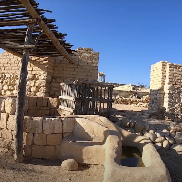
Here you can explore a well-planned Judean city: a massive gate complex, large storehouses, a sophisticated underground water system with a deep shaft, and the remains of a four-horned altar. These impressive features reflect the period of the kings of Judah, not the earlier patriarchal age.
While the precise location of Abraham’s well cannot be confirmed, the identification of this site is based on geography, long-standing tradition, and the continuity of the name Be’er Sheva.
Be’er Sheva lies at the edge of the Negev, a natural meeting point between farmland and desert pasture. It fits the biblical description of a place where herdsmen would dig wells and negotiate access to water. The name Be’er Sheva appears repeatedly in the Bible as the southern boundary of the land, “from Dan to Be’er Sheva.”
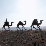
Even today, Bedouin communities south of Be’er Sheva maintain a semi-nomadic way of life. Like Abraham, some are shepherds, and their daily life is shaped by the challenges of the desert, reflecting the rhythms and practical needs that defined life in Abraham’s time.
It is also important to know that in the modern city of Be’er Sheva there is another well traditionally associated with Abraham, often called “Abraham’s Well,” which visitors can see. This reminds us that biblical memory can be tied to more than one location.
Tel Be’er Sheva therefore offers two layers of connection. One is the physical city of the Judean kingdom, with its water system, shaft, storehouses, and altar. The other is the biblical memory that places Abraham in this region, digging a well, making a covenant, and calling on the name of the Lord.
Ben Gurion’s Hut
Site 2
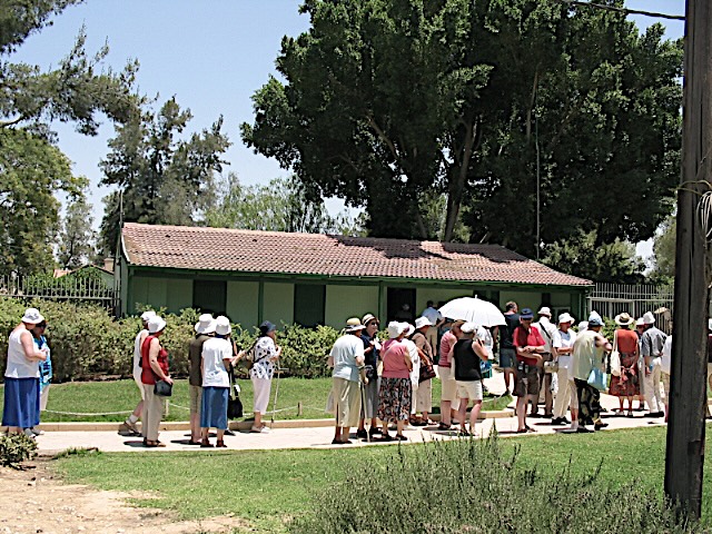
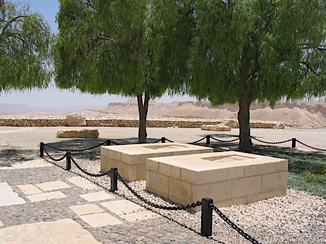
On the edge of the dramatic Zin Valley, in the heart of the Negev desert, stand the modest home of David Ben-Gurion and the grave where he and his wife Paula rest, overlooking the sweeping landscape. Israel’s first prime minister chose to leave Jerusalem and live here in Sde Boker, believing the future of the country depended on developing the desert.
The small wooden hut, his simple study, and the quiet surroundings allow visitors to step into the private world of a national leader. Over the years, his move turned Sde Boker into a symbolic site for Israelis. Even those who never settled in the desert come to see the hut, walk the paths, and feel the inspiration of a man who made the desert part of the nation’s vision.
Visiting Ben-Gurion’s hut and grave is not only a stop in history. It is an encounter with vision, humility, and the vast landscape that shaped modern Israel.
Continue reading
When David Ben Gurion resigned from political life in 1953, he chose to leave Jerusalem and settle in the small kibbutz of Sde Boker. For many, it was a surprising decision. For him, it was a statement. He believed that the future of Israel depended on developing the Negev. If the desert would flourish, the country would be secure and strong.
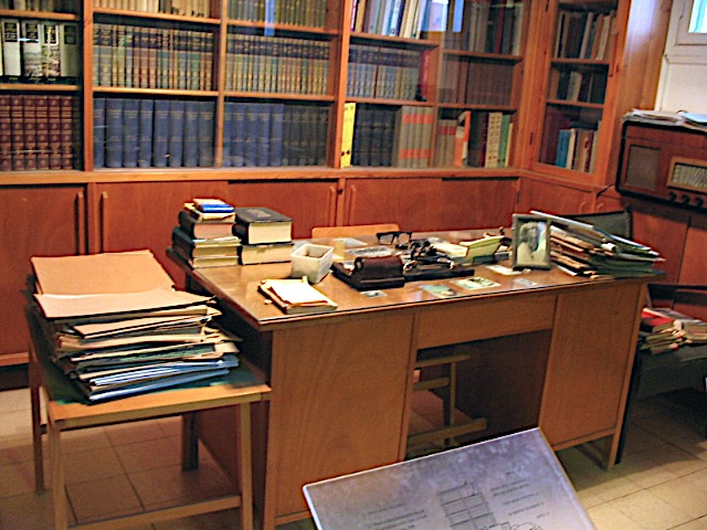
The hut itself is extremely modest. A small kitchen. A simple bedroom. A narrow work desk. The shelves of his study are filled with thousands of books in many languages. History, philosophy, Judaism, politics. Even after leaving office, he continued to read and write every day.
One detail inside the house stands out. On the wall hangs a large portrait of Mahatma Gandhi. Aside from photographs of his wife Paula and a formal image of himself, the house is almost bare. The presence of Gandhi’s portrait reveals something about Ben-Gurion’s inner world. Like Gandhi, he understood that humility, simplicity, and personal example could be a powerful tool. By living modestly in the desert, he showed Israelis that leadership was not about luxury or titles but about vision, discipline, and commitment to the nation. His modest life gave him moral authority and inspired others to act, turning ordinary choices into lessons for the country.
There is also a well-known story that when John F. Kennedy, before becoming President of the United States, wished to meet Ben-Gurion, he was told that he would have to travel to Sde Boker. According to the story, an embassy Cadillac drove along the dusty desert road to reach the modest hut. Whether remembered exactly or shaped by time, the story reflects an important truth. Ben-Gurion did not bend his principles for prestige. If one wished to see him, one came to the desert.
A Personal Memory
As a child I once stood outside Sde Boker together with my father and thousands of Israelis who had come from all over the country. I remember hundreds of buses lining the desert roads and a huge crowd gathering under the open sky. It was late evening.
Ben Gurion stood on the stage. He was already an old man. His voice was thin, almost fragile, yet full of determination. I did not understand all the political details, but the moment was unforgettable. Arik Einstein, one of Israel’s most famous singers, performed that evening. His music carried over the desert as darkness slowly fell. For a child, the desert, the crowd, the voice, and the sense of history coming alive made a lasting impression.
Ben Gurion’s move to the desert made Sde Boker a symbolic site for Israelis. Even those who never settled in the Negev, or did not build anything in the desert, came to see the hut, walk the quiet paths, and feel the inspiration of a man who used humility, simplicity, and example as a tool to shape the nation. School trips, family visits, and tourists continue to bring the site to life, making it both a historical landmark and a place of reflection.
Avdat – Nabatean Heritage
Site 3
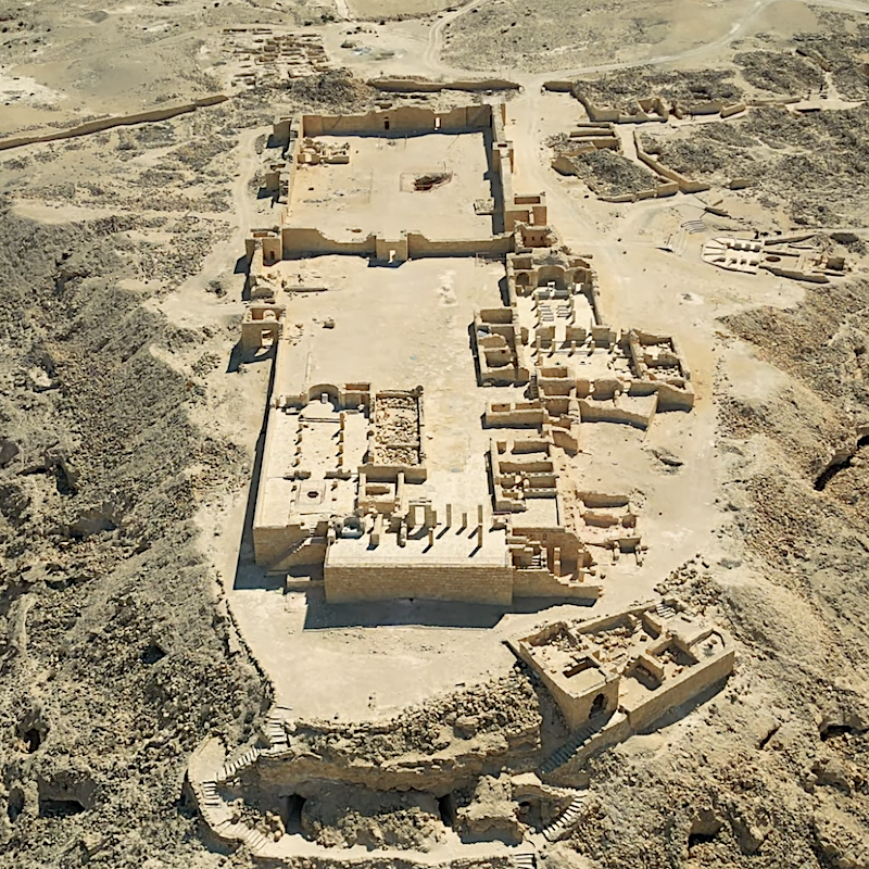
South of Sde Boker, on a high desert ridge, stands Avdat. What looks today like silent ruins was once a vital station on the Incense Route — the ancient trade network that connected Arabia with the Mediterranean world.
Avdat belonged to a chain of Nabataean desert cities. Together with Petra in Jordan, and Shivta, Mamshit and Haluza in Israel, it served caravans carrying frankincense, myrrh and spices across the desert.
In 2005, this desert route and its cities were recognized by UNESCO as a World Heritage Site — a reminder that the Negev once stood at the center of international trade.
Continue reading
Avdat was founded in the 3rd century BCE and named after the Nabataean king Obodas I. The city flourished between the 1st century BCE and the 2nd century CE, when caravan trade reached its peak. Positioned high above the desert, Avdat served as both a fortified lookout and a resting station for traders crossing the Negev.
The Nabataean kingdom stretched from today’s Jordan deep into the Negev. Its capital was Petra, carved into red sandstone cliffs. But Petra’s wealth depended on desert stations like Avdat. Caravans traveling north from Arabia stopped at a chain of settlements where water was stored, goods were protected and taxes were collected.
This network formed part of the Incense Route, a trade system about 2,400 kilometers long that began in Oman and Yemen, crossed Arabia and Jordan, passed through the Negev and ended at the port of Gaza. From the 3rd century BCE to the 3rd century CE, caravans carried frankincense, myrrh and spices to the Hellenistic and Roman world.
In 2005, UNESCO inscribed the Incense Route from Orhan Mor in the Arava to Avdat as a World Heritage Site. The recognized section includes Avdat together with Haluza, Shivta and Mamshit. The remains of cities, forts, milestones and agricultural systems show how the Nabataeans turned the desert into a thriving landscape for nearly 700 years.
What makes Avdat remarkable is also its water system. The Nabataeans collected runoff from winter rains and built terraces, channels and reservoirs that made farming possible in this dry region.
In 106 CE the Roman Empire annexed the Nabataean kingdom. Trade gradually declined, and Avdat later revived in the Byzantine period as a Christian center, when two churches were built on the acropolis.
Today, walking through Avdat, you see layers of Nabataean, Roman and Byzantine history — and the same vast desert caravans once crossed on their journey between Arabia and the Mediterranean.

Lot’s Wife – Mount Sodom
Site 4
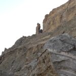
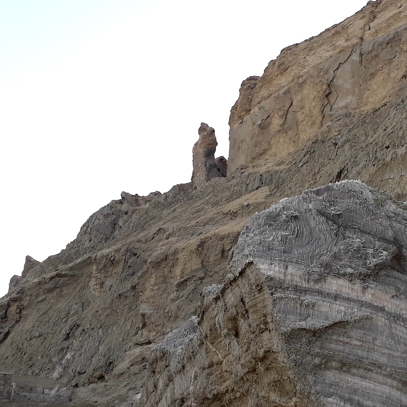
If you are driving along the southern Dead Sea, this is a worthwhile stop. From a distance Mount Sodom looks like the other desert mountains around it, brown and rugged under the sun. But when you stand beside it, you begin to notice something different. Some of the rocks scattered along the slope are pure salt. You can even test it yourself and taste the salt in the stone. Rising from these cliffs stands a tall pillar that looks almost human. Tradition calls it Lot’s wife.
Continue reading
Sometimes the stories of the Bible are revealed in unexpected ways. Not only in ancient ruins or broken walls, but in the landscape itself. This lonely formation takes us into one of the most dramatic scenes in the Book of Genesis. A powerful dialogue between God and Abraham. A fertile plain filled with corruption. Angels arriving at night. A desperate escape at dawn. Fire falling from the sky. And one forbidden glance backward that changed everything.
Lot, the nephew of Abraham, chose the fertile plain of the Jordan, described in the Bible as well watered and lush (Genesis 13:10–12). At first he pitched his tents near Sodom (Genesis 13:12). Later he was living within the city itself, sitting at its gate (Genesis 19:1). The land appeared prosperous and inviting. But the people of Sodom were described as deeply sinful before God (Genesis 13:13)
God revealed to Abraham that Sodom and Gomorrah would be destroyed. Abraham pleaded for the cities, asking if they would be spared for the sake of fifty righteous people, then forty, thirty, twenty, even ten. But not even ten could be found (Genesis 18:20–33).
Two angels came to rescue Lot and his family and warned them to flee without looking back (Genesis 19:1–17). As they escaped, fire and brimstone fell from the sky and smoke rose from the land (Genesis 19:24–28). Then, in a single moment, Lot’s wife turned to look behind her, and she became a pillar of salt (Genesis 19:26).
But where were Sodom and Gomorrah actually located?
The Bible places them in the plain of the Jordan, near the Dead Sea. Over the years, scholars and archaeologists have suggested different locations. Some identify the cities with sites in the southeastern Jordan Valley. Others point to areas near the southern basin of the Dead Sea, not far from Mount Sodom itself. There are even proposals north of the sea.
No single location has been proven beyond doubt. The landscape has changed dramatically over thousands of years. Earthquakes, shifting water levels and erosion have reshaped the region.
Yet beside Mount Sodom, with the desert silence around you and the salt mountain rising at your side, the ancient story feels close and real.
Ein Ovdat
Site 5
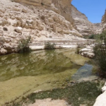
If you are searching for a quiet corner of the desert where water shapes the land, Ein Ovdat offers clear pools and winding streams tucked between cliffs. Birds flit among the trees, ibex climb rocky slopes, and the oasis invites you to pause and feel the desert’s unexpected life.
Continue reading
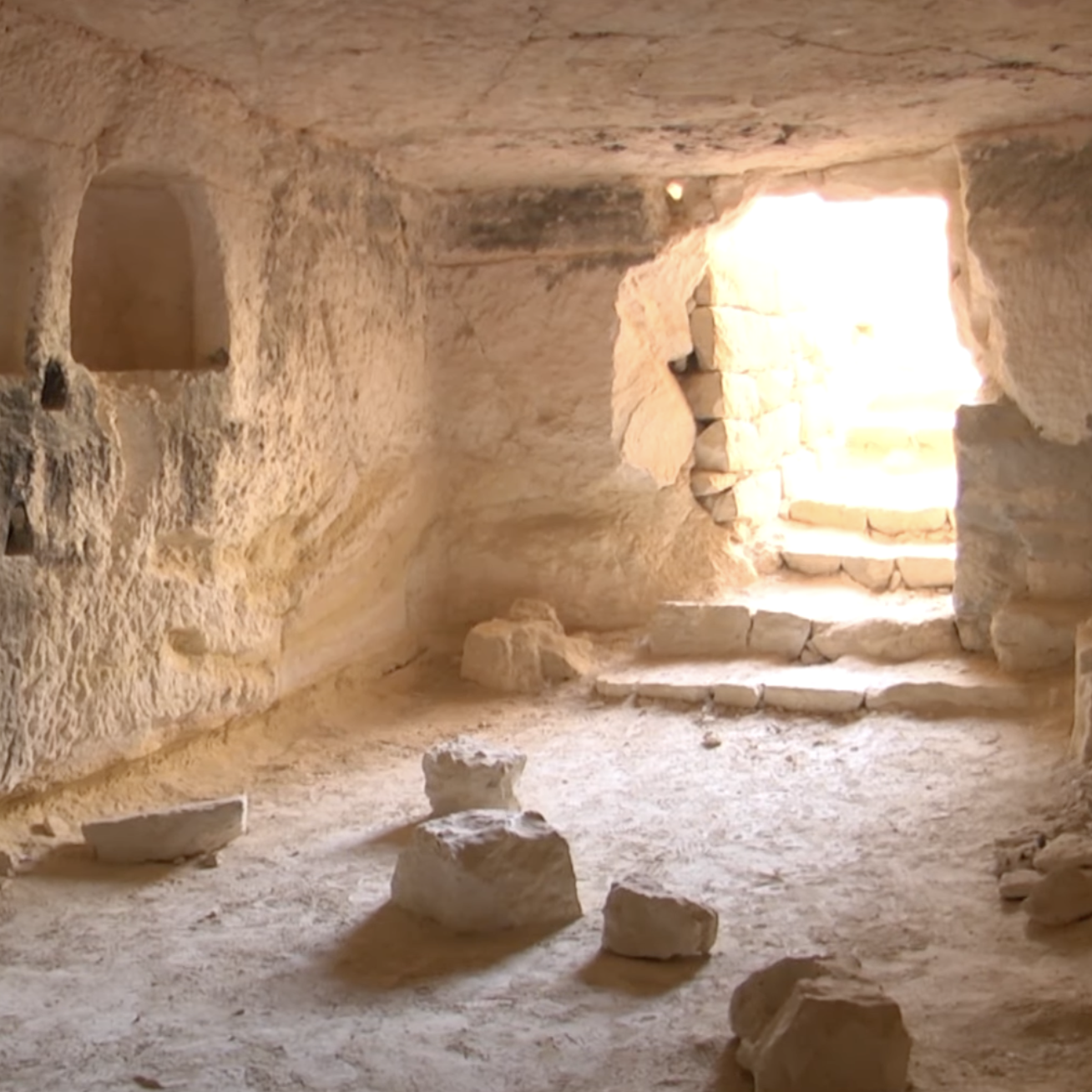
Ein Ovdat has served travelers for thousands of years. Nabatean caravans rested here along trade routes linking Petra to the Mediterranean. Later, desert dwellers, monks, and Bedouin shepherds relied on its springs for survival. Terraces and stone structures remain, showing how people adapted to the desert environment with care and ingenuity.
Walking the trails, visitors follow streams threading through narrow canyons, past waterfalls and reflective pools. Panoramic viewpoints reveal the vast Negev, while wildlife thrives. Ibex navigate steep cliffs, birds nest in shaded trees, and small mammals drink from the spring-fed pools.
Legends linger among the rocks. Some say the oasis is named after the biblical figure Obadiah. Others tell of travelers saved by its life-giving waters in times of drought. Visiting is best in cooler months, when flowing water and mild temperatures make hiking comfortable. Ein Ovdat is a place where history, nature, and the desert’s resilience converge.

Makhtesh Ramon
Site 6
If you are on your way down to Eilat, the most southern city in Israel, and you have some spare time, you maybe want to drive through one of the most impressive natural landscapes in Israel.
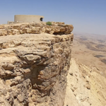
Makhtesh Ramon is a vast erosion crater in the heart of the Negev Desert. The cliffs, the open sky, and the deep silence create a powerful first impression. From the rim near the city of Mitzpe Ramon you can look down into a world shaped over millions of years.
Right on the edge of the crater you will find the Visitors Center, where the story of this unique landscape begins. When night falls, the same cliffs become one of the best places in Israel to look up at the stars.
Continue reading
Makhtesh Ramon is the largest makhtesh in the world. It was not formed by a volcano or a meteor, but by a long geological process in which softer rock layers eroded and collapsed inward, leaving a wide valley surrounded by steep walls. The exposed rock layers reveal ancient seas and desert climates that once covered this region.
The entire area is part of a protected nature reserve managed by the Israel Nature and Parks Authority. Trails lead along the rim and down into the crater, allowing visitors to experience its scale from above and from within. Ibex and desert wildlife can sometimes be seen moving quietly along the cliffs.
The Ramon Crater Visitors Center stands on the northern rim near the city of Mitzpe Ramon. Inside, interactive exhibits explain how the makhtesh was formed and why it is so rare in the world. Large windows open toward the crater, keeping the landscape constantly in view.
The center also includes a memorial dedicated to Ilan Ramon, Israel’s first astronaut. He was killed in 2003 when the space shuttle Columbia disintegrated during reentry into Earth’s atmosphere. His connection to the Negev and to Mitzpe Ramon adds a personal and national dimension to the visit.
Makhtesh Ramon is internationally known for its dark skies. Far from major cities, with very little light pollution, the crater has become one of the best stargazing areas in Israel. Guided night tours and local observatories offer visitors the chance to see planets, constellations, and the Milky Way clearly above the silent desert.
For travelers heading south to Eilat, a stop at Makhtesh Ramon can be a short scenic break with a walk along the rim. But you can also choose to stay the night in one of the hotels or guesthouses in and around Mitzpe Ramon. An overnight stay allows you to experience both sunset and sunrise over the crater, and to see the desert sky at its clearest. It is an encounter with deep time by day and with the universe by night.
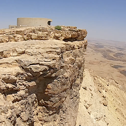
The Ramon Crater Visitors Center stands on the northern rim near the city of Mitzpe Ramon

